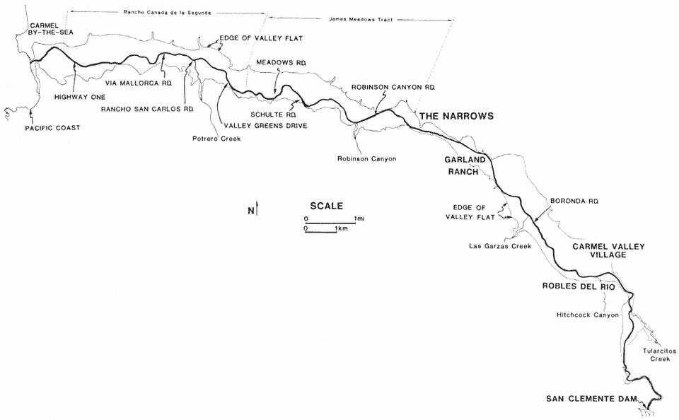
Location map: Middle and Lower Carmel River based on aerial photography in 1945.
A narrow channel with well-vegetated banks developed on the lower 15 km. of the Carmel River by 1939, and by 1960 this condition had extended to the entire lower 24 km. of river channel. Noticeable die-off of riparian trees near water supply wells began in the 1960s and intensified during the 1976–1977 drought. Substantial bank erosion occurred during the winters of 1978 and 1980 along reaches which had suffered loss of bank-stabilizing riparian trees.
From: The Role of Riparian Vegetation in Channel Bank Stability http://publishing.cdlib.org/ucpressebooks/view?docId=ft1c6003wp;chunk.id=d0e21500;doc.view=print
No comments:
Post a Comment