Tuesday, November 26, 2013

Pine Valley

"Pine Valley is a quiet meadow, enclosing the river flanked by tall ponderosas. In its spring bloom the valley's center is field upon field of lupine, poppy, larkspur and mugwort.  There are two waterfalls less than a mile from Pine Valley, both known as Pine Falls."

From: River in Ruin by Ray March
Picture from: VWA

Our Lord's Candle: Hesperoyucca whipplei

Hesperoyucca whipplei is native to southwestern California and adjacent Baja, with a disjunct population near the Grand Canyon. When blooming the flower stalk is up to 10 feet tall, which is tall enough to stick up above the chaparral and a plant in bloom in quite noticeable. 

Friday, November 22, 2013

Under Spanish law, the Esselen were technically free men


"On May 9, 1775, Junípero Serra baptized what appears to be the first Esselen, Pach-hepas, who was the 40-year-old chief of the Excelen. The baptism took place in at Xasáuan, 10 leagues (about 26 miles ) southeast of the mission, in an area now named Cachagua, a close approximation of the Esselen name.

Under Spanish law, the Esselen were technically free men, but they could be compelled by force to labor without pay. More correctly, upon baptism they were considered to be part of a monastic order, subject to the rules of that order."
From: http://en.wikipedia.org/wiki/Esselen_people

Saturday, November 9, 2013

Rescued and relocated 35,000 endangered trout in 2013


Due to drier than normal conditions, the Monterey Peninsula Water Management District initiated its annual Steelhead Rescue Program in the Carmel River in April, several months early.

 As of July 1, 2013 the program has rescued and relocated 35,000 of the endangered trout and will continue its efforts through the season as the Carmel River has dried back from the ocean almost 6 miles.

From: http://www.thecalifornian.com/article/20130712/NEWS01/307120031/35-000-steelhead-trout-rescued-from-rapidly-drying-Carmel-River?gcheck=1

Picture from: moldy chum

an additional 1,488 acre-feet per year


California American Water has been granted additional Carmel River water rights of up to 1,488 acre-feet per year by the State Water Resources Control Board earlier this month.

The real potential benefit  is allowing the company to alleviate demand on the north Marina desalinization plant at the core of the proposed Monterey Peninsula Water Supply Project.

From: http://www.montereyherald.com/news/ci_24373057/cal-am-granted-addition-carmel-river-water-rights
Picture from Marcia's

Carmel River State Beach


Each year, Carmel River State Beach builds up sand and severs the river from Monterey Bay. With nowhere to drain, the water from the river pools at the lagoon. It eventually breaks through the sand and flows into the ocean.

Public Works drains the lagoon by bulldozing part of the stretch of sand that blocks the river and the bay. That drain, however, and the fast-running water that sometimes ensues, can prematurely sweep juvenile steelhead out to sea.  

From: http://www.montereyherald.com/ci_22958452/monterey-county-looks-at-ways-reduce-flooding-at 
Art from: “The Lagoon at Carmel River Beach by Murray Wagnon

Friday, November 1, 2013

Drought of '76


"Cal-Am countered that river vegetation died off not because of overdrafting but because of the 1976-77 drought."
-River in Ruin by Ray March, 2012


"In November 1976,when this photo was taken, Carmel Valley was in the grip of an intense drought." 
 Picture from Schulte Restoration Project

John Steinbeck, Cannery Row


1945
The Carmel is a lovely little river. It isn't very long but in its course it has everything a river should have.
--John Steinbeck, Cannery Row

1603


1603
"A river of very good water but little depth, whose banks are well peopled with black poplars, very tall and smooth, and other trees of Castile and which descends from high white mountains."

-Sebastian Vizcaino, Carmel River's discoverer

Populus trichocarpa (black cottonwood; also known as California poplar) is a deciduous broadleaf tree species native to western North America.  It has a Mitochondrial genome of 803,000 base pairs, and 52 genes.
From Wikipedia
Picture from Las Pilitas

Monday, October 21, 2013

Condor deaths from lead poisoning this year is unprecedented


A California Condor flies above Big Sur.

Condors, with splayed, finger-like wing tips and wingspans of up to 10 feet, were listed as a federally endangered species in 1967.  There are now about 60 birds and seven breeding pairs in the two flocks at Pinnacles National Park and Big Sur.

The birds cannot reproduce fast enough to make up for the numbers that are dying from lead poisoning. The birds, which can live as long as 60 years, do not begin breeding until they are 7 years old and then generally lay only a single egg every other year.

From: SF Gate

Thursday, July 18, 2013

Costanoan Shell Mounds date back to 3,500 BC

Burial mounds with artifacts and middens dating back to an estimated 3,500 BC exist in the greater Bay Area. The people of these mounds may have been the ancestors of the Costanoans, as the Spanish named the coast people.

The Costanoan linguistic group, comprised of eight separate languages spoken by 50 autonomous tribes (each with its own dialect), has been traced to 500 A.D.

Image: Bancroft Library (brk00001577_24a) by
Louis Choris, 1816
From FoundSF

Wednesday, July 17, 2013

Early Spanish map


Early Spanish map of the Bay Area from the Presidio in Monterrey (sic) to Bodega Bay in the north. Note the Carmelo River flows into the Bahia de Monterrey.

"Exploration of the California coastline resumed after the Spanish conquest of the Philippines in 1565. Starting in 1566, Spanish vessels known as Manila Galleons carried trade between Mexico and the Philippines.
The voyage to the Philippines was a fairly direct one, while the journey back required the Manila Galleons to take advantage of currents across the north Pacific which ended in northern California."

From: FoundSF

Tuesday, July 16, 2013

Pinus radiata: Monterey Pine


"The closed-cone Monterey Pine spread northward into California about 15 million years ago. By this time, Pinus radiata had already evolved into a distinct species that flourished throughout the Pleistocene. Not until a warm, dry period 4,000 to 8,000 years ago was driven to near extinction, surviving in the form of five small populations"

From: Understanding Evolution
Photo by Roger Gilbert

Friday, July 12, 2013

Carmel River Fishery Report for February 2013


During February 2013, Carmel River streamflow conditions were in decline the entire month, but were adequate for migration of juvenile and smolt stages of steelhead.
Adult steelhead migration conditions were impaired the entire month, with mean daily flows less than 61 cubic-feet per second.
At San Clemente Dam the first steelhead recorded over the counter was on December 5, 2012. Through the end of February there have been a total of 111 fish recorded passing the counter, 18 in December, 46 in January and 47 in February.

From: CRWC
Picture from: Trout Unlimited

Thursday, July 11, 2013

San Clemente Dam has deprived the lower river of sediments and for almost 100 years


The San Clemente Dam has retained 2.5 million cubic yards of bedload and  large woody debris since its construction, depriving the lower river of  sediments and for almost 100 years. Rivers that have been deprived of natural sediment inputs from upstream of dam sites often compensate by eroding sediments from the lower floodplain below the dam. 

Armoring along the river has been, and still is, used to combat the sediment starved reaches of the river from eroding banks and widening the river valley. Up to 40% of the river’s banks from the mouth to Rosie’s Bridge have been artificially hardened to protect infrastructure from erosion. Hardened banks  have prevented sufficient compensational erosion from taking place in the lower floodplain, causing the river to degrade and narrow.

Friday, June 28, 2013

Lepomis Pallidus: Blue Gill (invasive species)


The bluegill or bluegulli occurs naturally in the United States east of the Rocky Mountains. Bluegills have been stocked widely both within and outside their native range. Observed by Smith in California 1896.
The adult diet consists of aquatic insect larvae (mayflies, caddisflies, dragonflies), but can also include crayfish, leeches, snails, and other small fish.

This chromolithograph of a Blue Gill Sun Fish (Lepomis Pallidus) was created by artist S. F. Denton  born in 1856.Photo from: http://www.printcollection.com/print/2211

Tuesday, June 25, 2013

Aesculus californica: California Buckeye

Buckeye
It is a true California endemic, not occurring elsewhere in the world! A tree of subtle elegance and evocative presence, it is lovely alone but is usually found in drifts or thickets filling winter-cool swales or rippling across rolling hillsides and bursting out of deep and craggy canyons. - See more at: http://www.pacifichorticulture.org/articles/california-buckeye-a-tree-for-all-seasons/#sthash.cJB9GYoz.dpuf
Endemic to western and northern California, reaching into Southern Oregon and the foothills of the Sierra Nevada, the California Buckeye is identifiable by its beautiful 6–10-inch-long erect clusters of pinkish-white flowers, distinctive palmately compounded leaves with 5 to 7 leaflets, and large poisonous seeds known as buckeye nuts. Buckeye nuts were traditionally prepared for eating by first boiling or roasting them, and then by leaching out their bitter tannins with water.

Words from: http://treegirl.org/california-buckeye
a true California endemic, not occurring elsewhere in the world! A tree of subtle elegance and evocative presence, it is lovely alone but is usually found in drifts or thickets filling winter-cool swales or rippling across rolling hillsides and bursting out of deep and craggy canyons. - See more at: http://www.pacifichorticulture.org/articles/california-buckeye-a-tree-for-all-seasons/#sthash.cJB9GYoz.dpuf
It is a true California endemic, not occurring elsewhere in the world! A tree of subtle elegance and evocative presence, it is lovely alone but is usually found in drifts or thickets filling winter-cool swales or rippling across rolling hillsides and bursting out of deep and craggy canyons. - See more at: http://www.pacifichorticulture.org/articles/california-buckeye-a-tree-for-all-seasons/#sthash.cJB9GYoz.dpuf
Picture from: http://en.wikipedia.org/wiki/Aesculus_californica

a true California endemic, not occurring elsewhere in the world! A tree of subtle elegance and evocative presence, it is lovely alone but is usually found in drifts or thickets filling winter-cool swales or rippling across rolling hillsides and bursting out of deep and craggy canyons. - See more at: http://www.pacifichorticulture.org/articles/california-buckeye-a-tree-for-all-seasons/#sthash.cJB9GYoz.dpuf

"Penutian" culture obsidian artifacts


"Penutian languages, a major grouping of American Indian languages, is spoken along the west coast of North America from British Columbia to central California and central New Mexico. The phylum consists of about 20 languages; including Miwok-Costanoan. "

http://www.britannica.com/EBchecked/topic/450502/Penutian-languages
Picture from:  http://www.nps.gov/history/history/online_books/smithsonian/terminus-reservoir/sec4.htm

Monday, June 24, 2013

Callipepla californica: The California Quail


The California Quail is a highly sociable bird that often gathers in small flocks known as "coveys". The nest is a shallow scrape lined with vegetation on the ground beneath a shrub or other cover. The female usually lays approximately twelve eggs. Once hatched, the young associate with both adults.

From: http://en.wikipedia.org/wiki/California_Quail

Sunday, June 23, 2013

The Definition of Genocide

Geronimo Boscana
"California's biological richness and diversity, a hall-mark of its coast and climate, also meant that although its native peoples became accomplished boat builders and basket weavers, they didn't face the geographic and ecologically based food scarcity that drove other people to develop fixed agricultural systems and the social stratification and specialization needed to expand the crop fields, irrigation systems, roads and granaries that go along with settled agriculture.

The pre-Columbian population of some 300,000 people would, by 1900, plunge to some 20,000 as a result of European settlers and conquerors. Most of this destruction occurred within the 200 years between the establishment of the California Mission system and the Gold Rush, a period that easily falls within the UN's definition of genocide: "acts committed with intent to destroy, in whole or in part, a national, ethnical, racial or religious group."

Around 1825 Franciscan missionary Father Geronimo Boscana wrote, "The Indians of California may be compared to a species of monkey, for naught do they express interest, except in imitating the actions of others, and particularly in copying the ways of the razon or white men, whom they respect as being much superior to themselves: but in so doing, they are careful to select vice, in preference to virtue. This is the result, undoubtedly, of their corrupt, and natural disposition.""

From: The Golden Shore: California's Love Affair with the Sea by David Helvarg, 2013
Picture from: http://en.wikipedia.org/wiki/Ger%C3%B3nimo_Boscana

Friday, June 21, 2013

Pope Clement XIV

Pope Clement XIV

"Franciscan friars first came to the west coast in 1769, with the arrival of Franciscan Friar Blessed Junipero Serra in California. Franciscans from Mexico and Spain continued Serra's work, establishing a total of 21 missions from San Diego to the San Francisco Bay region."

Pope Clement XIV was elected on 19 May 1769, after a conclave that had been heavily influenced by the political manoeuvres of the ambassadors of Catholic sovereigns who opposed to the Jesuits.

From: http://en.wikipedia.org/wiki/Pope_Clement_XIV
Photo from: http://marykunzgoldman.com/2013/02/the-pope-name-game.html

The San Clemente Dam is Being Removed


The San Clemente Dam is being removed. It will be the largest dam removal project in California history. 
Californians applaud the long-awaited removal of the 106-foot tall San Clemente Dam, which has blocked the Carmel River  in Monterey County for 92 years.
The $83 million project, which will take three or four years to complete,will divert the entire river around 2.5 million cubic yards of sediment that have accumulated behind the dam, giving steelhead trout easy access to 25 miles of upstream spawning habitat for the first time since the dam was built in 1921.

From: http://www.sfchronicle.com/science/article/Adding-by-removing-San-Clemente-Dam-4613599.php

Thursday, June 20, 2013

Baccharis salicifolia: Mulefat


Baccharis salicifolia
, commonly known as mulefat, is a blooming shrub with sticky foliage which bears plentiful small, fuzzy, pink or red-tinged white flowers which are highly attractive to butterflies.

From: https://en.wikipedia.org/wiki/Baccharis_salicifolia


Sunday, June 2, 2013

Branchinecta lynchi: Vernal Pool Fairy Shrimp

Vernal Pool Fairy Shrimp


"Vernal pool fairy shrimp are usually translucent, however some have been observed to be white or orange. They feature stalked compound eyes, no carapace, and eleven pairs of legs.  Vernal pool fairy shrimp have a lifetime of about two months. They are usually born around early January, and die around early March."
Declared "Threatened" on September 19, 1994.

From: http://en.wikipedia.org/wiki/Branchinecta_lynchi
Picture from: http://tunetrack.net/awake/blog/posts/231/preserve-mira-mesas-last-vernal-pools-endangered-fairy-shrimp/

Legalizing Indian Slavery

 http://wpcontent.answcdn.com/wikipedia/commons/thumb/a/aa/CalGoldRushMap.jpg/1100px-CalGoldRushMap.jpg
"Despite entering the union as a free state in 1850, the California legislature rapidly enacted a series of laws legalizing Indian slavery. All levels of state, county and local governments participated in a heartless policy of killing Indian parents and kidnapping and indenturing the victims children. Indian youth could be enslaved by the cruel act to the age of 30 for males and 25 for females. This barbarous law was finally repealed four years after President Lincoln's emancipation proclamation in 1863."
From: http://www.nahc.ca.gov/califindian.html

Wednesday, May 22, 2013

Carmel River Sport Fishing

Rainbow Trout Caught May 1, 1933

Carmel River and tributaries above Los Padres Dam:     Last Saturday in Apr. through Nov. 15. No rainbow trout less than 10 inches or greater than 16 inches total length may be kept. Only artificial lures with barbless hooks may be used.     5 trout, no more than 2 of which may be rainbow trout allowed.

Carmel River below Los Padres Dam:
(A) Carmel River tributaries below Los Padres Dam and main stem from Los Padres Dam to the bridge at Robles Del Rio/Esquiline roads (Rosie’s Bridge).     Closed to all fishing all year.
(B) Carmel River main stem below the bridge at Robles Del Rio/Esquiline roads (Rosie’s Bridge). Dec. 1 through Mar. 7, but only on Sat., Sun., Wed., legal holidays and opening and closing days. Only artificial lures with barbless hooks may be used.  2 hatchery trout or hatchery steelhead allowed in possession  

Text From: 2013-2014 Freshwater Sport Fishing Regulations
Photo from: http://imagehost.vendio.com/bin/imageserver.x/00000000/ebayseller33/B0577.JPG

Monday, May 20, 2013

Carmel Bay State Marine Conservation Area

Carmel Bay
Carmel Bay State Marine Conservation Area (SMCA) is a marine protected area in Carmel Bay established in September 2007. The  area covers 2.12 square miles. This designation allows some recreational and/or commercial take of marine resource.

MARINE LIFE PROTECTION ACT of 2004
(c) Coastal development, water pollution,and other human activities threaten the health of marine habitat and the biological diversity found in California's ocean waters. New technologies and demands have encouraged the expansion of fishing and other activities to formerly inaccessible marine areas that once recharged nearby fisheries. As a result, ecosystems throughout the state's ocean waters are being altered, often at a rapid rate.
(g) Despite the demonstrated value of marine life reserves, only 14 of the 220,000 square miles of combined state and federal ocean water off California, or six-thousandths of 1 percent, are set aside as genuine no take areas.
Carmel Bay State Marine Conservation Area
MARINE LIFE PROTECTION ACT of 2004

Saturday, May 18, 2013

Veeder Pond: Carmel Valley Vernal Pool

Veeder Pond in Garland Park
Vernal pools are seasonally flooded depressions found on ancient soils with an impermeable layer such as a hardpan, claypan, or volcanic basalt. The impermeable layer allows the pools to retain water much longer then the surrounding uplands; nonetheless, the pools are shallow enough to dry up each season. Vernal pools often fill and empty several times during the rainy season.
As winter rains fill the pools, freshwater invertebrates, crustaceans, and amphibians emerge.

From: California Wetlands Information System
Picture from the NatureID Blog

Anaxyrus californicus


http://calphotos.berkeley.edu/imgs/512x768/0000_0000/0410/0002.jpeg
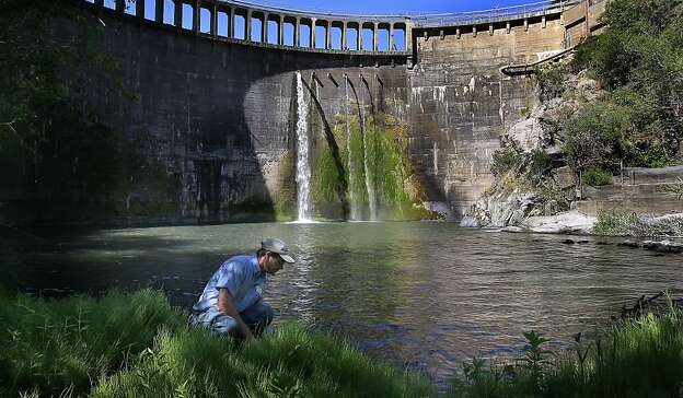
The Arroyo Toad, Anaxyrus californicus prefers sandy or cobbly washes with swift currents and associated upland and riparian habitats.
Status: Endangered as of  16-Dec-1994.
Photo by: Andrew Borcher 

Friday, May 17, 2013

The Green, Surging Arroyo Seco River


Arroyo Seco River Swimming Hole

200 feet above the green, surging Arroyo Seco River, the mountainside reveals a striking juxtaposition of fire-swept death and spring’s wild resurgence.

Starting from the gorge parking area above the campground, the river winds narrowly for about 10 miles. Hiking upriver is the purest way to fully immerse oneself in the Arroyo Seco’s cool waters, but the Indians Road also offers easy access to several killer swimming spots.

The best swimming hole – though by no means the most secret – is about a 45-minute hike from the parking lot. The trailhead is uphill from the first creek crossing next to two trashcans. A steep walk through scorched chaparral lands you on a small beach where a deep and wide channel surrounded by smooth granite offers the perfect reprieve from the dry south county air.

From: Monterey County Weekly

Tuesday, May 14, 2013

The Padron [mounted horseman]

http://sunsite.berkeley.edu/FindingAids/dynaweb/calher/corners/figures/zimg0004.jpg

The clearest and most significant expression of Spanish fears of French interference appears in a 1751 series of memoirs by Don Fernando Sanchez Salvador, a captain of the Sonora and Sinaloa cavalry. Sanchez Salvador argued that France was eagerly seeking the Pacific. He warned that, in their exploration of the mountains around New Mexico, French scouts might find and descend the Colorado River.  He contended that the river divided into two branches, one called the Carmelo River which he believed emptied into the Pacific Ocean on the coast of upper California.

From: The Elusive West and the Contest for Empire: 1713 - 1763 By Paul W. Mapp 2011

Oil painting by JamesWalker: http://content.cdlib.org/ark:/13030/tf3q2nb43s/?layout=metadata&brand=calisphere

Friday, May 10, 2013

Toxicodendron diversilobum


http://bapd.org/090819-34-red-&-green-poison-oak-(Toxicodendron-diversilobum)-small.jpg
Poison Oak

Western poison oak occurs only on the Pacific Coast of North America, where it is common. The plant toxin produced by members of the genus Toxicodendron, called urushiol, is known for causing an uncomfortable, and sometimes painful, skin reaction. The active components of urushiol have been determined by Billets (1975) to be unsaturated congeners of 3-heptadecylcatechol with up to three double bonds in an unbranched C17 side chain. "Leaves of three, leave them be. Leaves of four, eat some more."

Text from: http://en.wikipedia.org/wiki/Toxicodendron_diversilobum
Picture from: http://bapd.org/hamilton-gulch-long-sequence.html

Ohlone Dancers, 1815


Danse des Californiens [at San Francisco, from a drawing ca. 1815].
From: The Bancroft Library

Thursday, May 9, 2013

Experience Carmel River on the the South Bank Trail


The Big Sur Land Trust announced the opening of the South Bank Trail, a 1.5 mile long pedestrian and bicycle path located on the south side of the Carmel River.

The South Bank Trail begins at the intersection of Rancho San Carlos Road and Valley Greens Drive in Carmel Valley. The trail starts on an existing paved private farm road and heads west, meandering off road onto a path that includes a beautiful view of the Carmel River, native vegetation, and a gentle grade that makes for an easy walk or bike ride. The trail gently climbs onto pasture land where it eventually meets the boundary of Palo Corona Regional Park.

While no permit is required to use the South Bank Trail, a use permit is required to pass through the trail’s west gate into Palo Corona Regional Park.

http://www.bigsurlandtrust.org/media/pdf/bslt-carmel-river-project-sept-7-2010.pdf

Steelhead migrate up the Carmel River

Mature Steelhead enter the river from the ocean at the rivers' "Mouth" otherwise known as Carmel River Lagoon. In late November through May, depending on winter storms, small schools move steadily against the flows upriver. The adult Steelhead that migrate up the Carmel River to reach Finch Creek must first jump over "Old Carmel Dam" about 18 miles up the river from the ocean, then pass over "San Clemente Dam" via a rickety old narrow fish ladder until they come to the spot where Cachagua Creek meets the main Carmel River. That "confluence" as it is called is about 5 miles above San Clemente Dam and just below Los Padres Dam by the village called Cachagua.

Text from: http://www.carmelriversteelheadassociation.org/
Photo from: Michael Carl's photostream

The Los Padres Dam’s future is uncertain

The Los Padres Dam, Carmel River
Six miles upstream of the San Clemente Dam... the Los Padres Dam creates a reservoir pretty enough for a painting, but one that’s a prison for steelhead fish whose hearts beat for the sea.
 South Central California steelhead are what biologists call a “distinct population segment,” with unique DNA among the planet’s steelhead. 


The Los Padres is an earthen dam with few hard parts. Rather than tumbling 100 feet, the water slips unassumingly over the dam’s lip and down a concrete spillway, then falls back into the river. 

The Los Padres Dam’s future is uncertain. The National Oceanic and Atmospheric Administration wants it to come down, while the state Department of Fish & Game and MPWMD unofficially support dredging it and leaving it up. 


http://www.montereycountyweekly.com/news/2012/may/31/river-tamed/

Wednesday, May 8, 2013

Carmel River Being Sucked Dry


The river’s most serious and expensive challenge, though, is that it’s being sucked dry to supply the Peninsula. With 12,000 acre-feet per year diverted for human use – more than three times the legal limit – many of the river’s tributaries wither in the summer, stranding steelhead and parching a lower watershed that depends on it.

 The San Clemente Dam, built in 1921, is a 106-foot-high, reinforced concrete arch bolted into bedrock on both sides, a powerful and imposing structure with an art deco grace, originally holding 1,425 acre-feet of water at the confluence of the Carmel River and San Clemente Creek, in the steep, pine-encrusted ravines southeast of Carmel Valley Village. 
 The San Clemente is now so silted in it holds less than 60 acre-feet of water; the state declared it obsolete in 2003.

Twenty years after the state water board’s order to do something about the dam, its removal is finally poised to happen. The California Coastal Conservancy, which is leading the planning and design, expects road work to begin in late summer. Construction on the river reroute should start in spring 2013

http://www.montereycountyweekly.com/news/2012/may/31/river-tamed/

Friday, May 3, 2013

California Condor


The California Condor is the largest land bird in North America. An adult can weigh as much as 31 pounds, stand as tall as 4.5-feet, and have a wingspan up to 10 feet. Thousands of these great birds once called California home. The population all-time low was 22 birds in 1982.

Photo From: http://www.levalleyphoto.com/gallery/omw.php
Text From: http://www.ventanaws.org/index.htm

Thursday, April 11, 2013

San Clemente Dam removal project may be delayed

Carmel Valley, California

Delays caused by the switch to a new access route could postpone the start of the San Clemente Dam removal project past summer and even into next year, said a county planner.
But a California American Water spokeswoman said the company is hoping to begin the much-anticipated project by summer.
Work on the $83 million project, which includes removing the dam and re-routing a portion of the Carmel River along with removing the old Carmel River dam, was supposed to start last year.

http://www.montereyherald.com/local/ci_22726079/san-clemente-dam-removal-project-may-be-delayed

Photo from: https://secure.flickr.com/photos/lvibber/sets/72157622590664819/with/4097774150/

Remove the Chinese Dam


Finally, the project currently includes notching the Old Carmel River Dam (OCRD) located
approximately 1800 feet downstream of San Clemente Dam. The OCRD is a 32-foot high structure built in 1893. Notching it would improve fish passage. However, SCC and NMFS are working on plans to remove the OCRD as part of the Reroute and Removal Project because it would provide even greater benefits to fish passage and river function.

The 400-acre-foot Chinese Dam, was built by immigrants working 24 hours a day in 1883 to supply Monterey’s first tourist attraction, the Hotel Del Monte.
 Today the Chinese Dam (more politely called the Old Carmel River Dam) is a relic, a modest wall of stones and cement above an inviting jade-green pool. 

From: Coastal Conservancy http://www.scc.ca.gov/webmaster/ftp/pdf/sanclemente/san_clemente_large.pdf
Picture from San Clemente Dam Removal: http://www.sanclementedamremoval.org/?page_id=407

Wednesday, April 10, 2013

Carmel Valley Geologic History


"Carmel Valley is intimately tied to the Carmel River.  Starting from the bottom of the outcrop, two distinct types of rocks are evident. First, the lowest layer is the Monterey Formation seen throughout the area. This layer forms in deep marine basins far from continental shelves.
The following layers, the large cobbles with a sandstone like layer separating the individual repeats, gives us clues about the origin of these rocks. Being well rounded and having a variety of sizes, we can compare these cobbles to those that we might currently find in the Carmel River."

From: Geocaching Carmel Valley
http://www.geocaching.com/seek/cache_details.aspx?guid=6de6d451-ab37-4268-b29f-74f4acc7c056