Burial mounds with artifacts and middens dating back to an estimated
3,500 BC exist in the greater Bay Area. The people of these mounds may have been the ancestors of the
Costanoans, as the Spanish named the coast people.
The Costanoan
linguistic group, comprised of eight separate languages spoken by 50
autonomous tribes (each with its own dialect), has been traced to 500
A.D.
Image: Bancroft Library (brk00001577_24a) by
Louis Choris, 1816
From FoundSF
The Carmel River News Blog gathers any and all data concerning Carmel River, CA from any and all sources. No claims to veracity are made. All pictures and quotes are owned by their source websites. This site only scratches the surface of the ancient history of Carmel Valley.
Thursday, July 18, 2013
Wednesday, July 17, 2013
Early Spanish map
Early Spanish map of the Bay Area from the Presidio in Monterrey (sic) to Bodega Bay in the north. Note the Carmelo River flows into the Bahia de Monterrey.
"Exploration of the California coastline resumed after the Spanish conquest of the Philippines in 1565. Starting in 1566, Spanish vessels known as Manila Galleons carried trade between Mexico and the Philippines.
The voyage to the Philippines was a fairly direct one, while the journey back required the Manila Galleons to take advantage of currents across the north Pacific which ended in northern California."
From: FoundSF
Tuesday, July 16, 2013
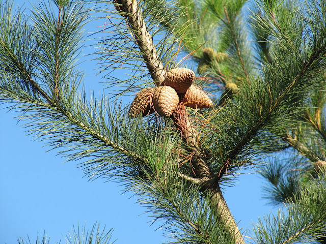
Pinus radiata: Monterey Pine
"The closed-cone Monterey Pine spread northward into California about 15 million years ago. By this time, Pinus radiata had already evolved into a distinct species that flourished throughout the Pleistocene. Not until a warm, dry period 4,000 to 8,000 years ago was driven to near extinction, surviving in the form of five small populations"
From: Understanding Evolution
Photo by Roger Gilbert
Friday, July 12, 2013
Carmel River Fishery Report for February 2013
During February 2013, Carmel River streamflow conditions were in decline the entire month, but were adequate for migration of juvenile and smolt stages of steelhead.
Adult steelhead migration conditions were impaired the entire month, with mean daily flows less than 61 cubic-feet per second.
At San Clemente Dam the first steelhead recorded over the counter was on December 5, 2012. Through the end of February there have been a total of 111 fish recorded passing the counter, 18 in December, 46 in January and 47 in February.
From: CRWC
Picture from: Trout Unlimited
Thursday, July 11, 2013
San Clemente Dam has deprived the lower river of sediments and for almost 100 years
The San Clemente Dam has retained
2.5 million cubic yards of bedload and large woody debris since its
construction, depriving the lower river of sediments and for almost 100
years. Rivers that have been deprived of natural sediment inputs
from upstream of dam sites often compensate by eroding sediments from the lower
floodplain below the dam.
Armoring along the river has been,
and still is, used to combat the sediment starved reaches of the river from
eroding banks and widening the river valley. Up to 40% of the river’s banks
from the mouth to Rosie’s Bridge have been artificially hardened to protect
infrastructure from erosion. Hardened banks have prevented sufficient
compensational erosion from taking place in the lower floodplain, causing the
river to degrade and narrow.
From: The Watershed Institute
Subscribe to:
Comments (Atom)


